
 EN
EN
 ar
ar bg
bg hr
hr cs
cs da
da nl
nl fi
fi fr
fr de
de el
el hi
hi it
it ko
ko no
no pl
pl pt
pt ro
ro ru
ru es
es sv
sv tl
tl iw
iw id
id lv
lv lt
lt sr
sr sk
sk sl
sl uk
uk vi
vi et
et hu
hu th
th tr
tr fa
fa ms
ms hy
hy ka
ka ur
ur bn
bn mn
mn ta
ta kk
kk uz
uz ku
ku
tiltmeters
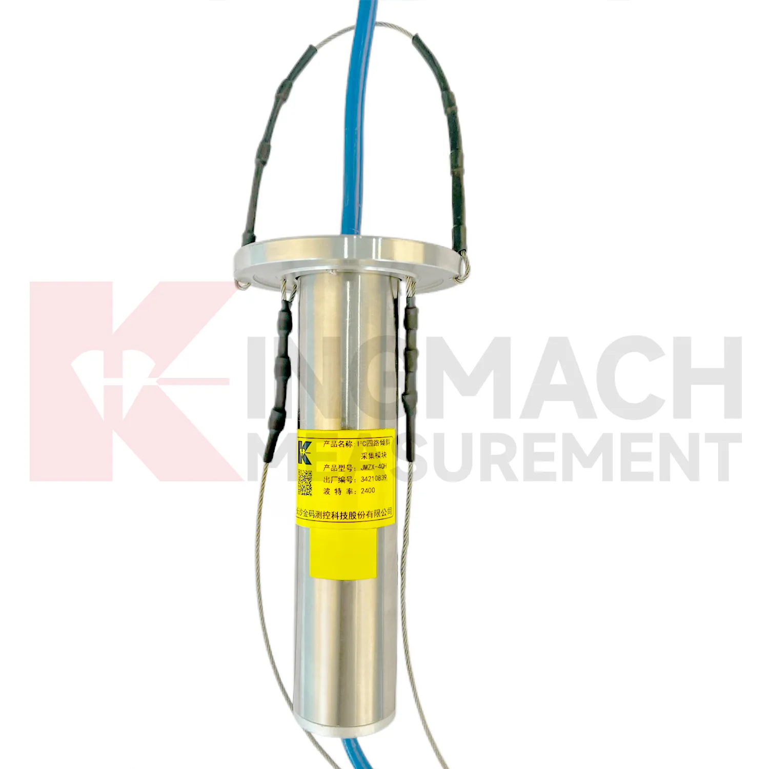
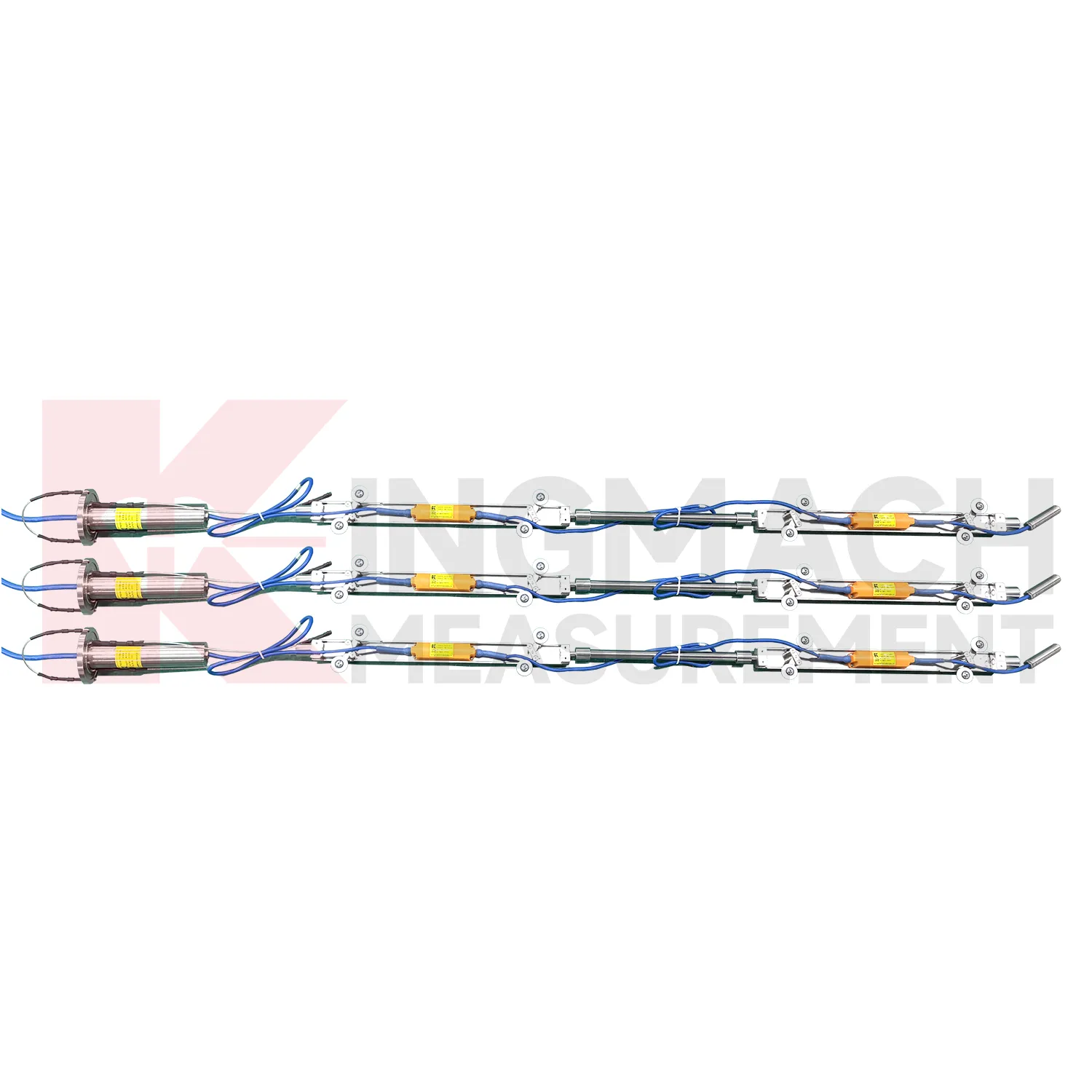
The JMZX-4QH acquisition module connects Kingmach tiltmeters into a multi-channel inclinometer data chain. It is used to collect measurement data from multi-point vertical in-place inclinometer strings and upload the data by wired or wireless means. Product details describe one controllable sensor power supply output, four downstream communication interfaces, automatic recognition, intelligent calculation after connection, and installation at the inclinometer tube orifice for waterproof and dustproof protection. The module supports up to 100 sensors through four channels. Published data includes DC 9V to 24V operating voltage, standby power below 0.5W, operation power below 4W, RS485 uplink communication with configurable baud rates, -30 degrees Celsius to +70 degrees Celsius operating temperature, about 70 mm length, about 1 kg weight, and IP67 protection. It is relevant when borehole sensors need organized power, communication, and upload control.
Application of tiltmeters
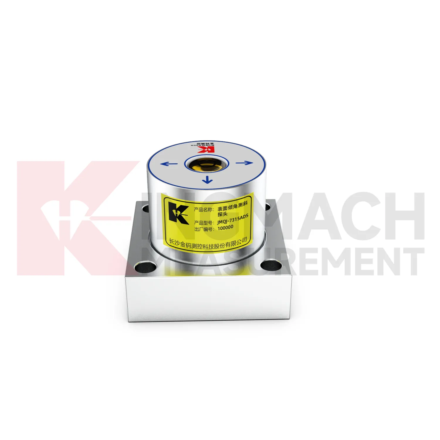
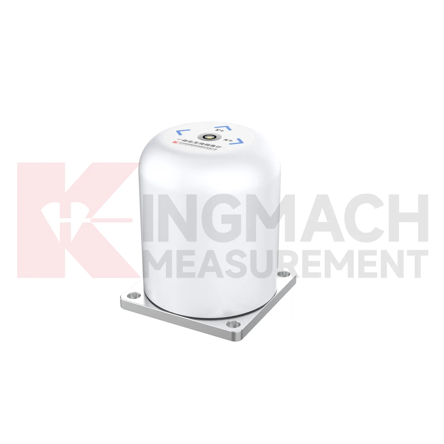
Wind tower and tall-structure monitoring can use tiltmeters to observe small angular changes caused by wind loading, foundation behavior, equipment operation, or nearby ground movement. An integrated JMQJ-7315RTU can be useful where wireless 4G reporting reduces long cable runs, while a wired JMQJ-7315ADS fits sites with existing acquisition cabinets. Tilt data should be reviewed with wind speed, vibration, foundation settlement, strain, and maintenance events. The axis direction must be aligned with the structure geometry so the data has engineering meaning. Battery condition, antenna signal, enclosure protection, and mounting bolt tightness are part of long-term reliability. For tall structures, even a small mounting error can create confusion, so baseline verification after installation is essential.
The future of tiltmeters
The future of tiltmeters will be shaped by cleaner digital records. Tilt monitoring often continues after the construction team leaves, so a future-ready file should keep model, range, serial number, axis direction, baseline, mounting photograph, channel address, communication mode, battery record, and maintenance notes together. Kingmach products already include electronic codes, digital communication, 4G output, and acquisition modules that can support this direction. The next step is making those records easy to hand over from contractor to owner. A tilt curve without installation context can be difficult to interpret years later. A tilt curve with a clear instrument history can support inspection, maintenance planning, and engineering review across the full service life of the structure.
Care & Maintenance of tiltmeters
Data review is part of maintaining tiltmeters. A curve should be checked for rate, direction, sudden jumps, missing values, repeated flatlines, and disagreement with nearby instruments. Compare tilt with settlement, displacement, strain, load, pore pressure, rainfall, vibration, and water level when available. For automated systems, verify channel names, units, time stamps, and alarm thresholds after platform changes. For manual readings, keep raw field notes and processed graphs together. If an alarm appears, inspect the mounting point, communication path, recent site work, and related instrument behavior. A good maintenance process treats data quality and field condition as one record, not two separate tasks.
Kingmach tiltmeters
Kingmach tiltmeters are useful when an engineering team needs tilt data that can be compared with displacement, settlement, strain, water level, or load readings. Tilt rarely stands alone. A retaining wall may rotate while a nearby displacement meter shows horizontal movement. A bridge bearing area may tilt as temperature and traffic change. A slope borehole may show deep lateral deformation before the ground surface opens. Kingmach JMQJ-7315ADS provides RS485 digital output for fixed tilt monitoring, and JMQJ-7315RTU provides 4G digital transmission for remote unattended work. These communication paths help put tilt data into a monitoring platform where engineers can compare time stamps and site events. The stronger the data chain, the easier it is to decide whether an angle change is structural behavior, installation disturbance, or a temporary environmental response.
FAQ
Q: How accurate is the JMQJ-7315ADS tiltmeter?
A: The product page lists 0.001 degree resolution and 0.01 degree accuracy for the +/-15 degree dual-axis model.Q: What protection grade does JMQJ-7315ADS have?
A: It is listed with IP68 waterproof protection and an operating environment from -30 degrees Celsius to +80 degrees Celsius.Q: What range does JMQJ-7315RTU provide?
A: The integrated wireless model lists +/-30 degree and +/-15 degree dual-axis range options, with 0.001 resolution.Q: How many sensors can JMZX-4QH support?
A: The module lists four channels and support for up to 100 sensors in a multi-point inclinometer system.Q: What is the guide wheel spacing for JMZX-7100L?
A: The sliding inclinometer page lists a 500 mm guide wheel spacing reference and a +/-90 degree sensor range.
Reviews
Daniel Brown
Excellent environmental monitoring sensors. The data is consistent, and the system integrates smoothly with our existing setup.
Michael Anderson
The strain gauges and load cells are extremely accurate and stable. They performed very well in our bridge monitoring project. Highly recommended!
Latest Inquiries
To protect the privacy of our buyers, only public service email domains like Gmail, Yahoo, and MSN will be displayed. Additionally, only a limited portion of the inquiry content will be shown.
Amelia***@gmail.comSingapore
Hello, I am looking for visualization software for monitoring system data analysis. Please let me kn...
Mia***@gmail.comNetherlands
Dear team, we are interested in your readouts & data loggers compatible with multiple sensors. Do yo...